For a coastal meadow going salty, the binding constraint is not how much salt arrives. It is where the salt ends up. Sea level rise and warming are pushing saltwater inland across low-lying coasts, and the usual expectation is that vegetation thins and then fails as salinity climbs past what the plants tolerate. But some meadows are not flat. They break into regularly spaced vegetated mounds a few centimetres high, separated by bare hollows, and that geometry changes the arithmetic.
A group at the Royal Netherlands Institute for Sea Research has now explained why, at a site near Yerseke where a decades-old patterned zone sits directly alongside an unpatterned meadow of the same plant. Rain falling on a mound drains off it and carries salt down into the neighbouring hollow. The mound stays comparatively fresh and grows well; the hollow accumulates salt and stays bare. Measured against its flat neighbour, the patterned meadow had less salt where the plants were, more biomass, more seed, and stayed green two to three weeks longer into autumn.
Why it matters: Restoration projects generally aim to rebuild a function, such as cover or productivity, and rarely try to rebuild a spatial pattern, which is often not even recorded. If the pattern is what buffers the stress, then levelling a landscape quietly removes the buffer.
The study, by Wu et al. at the Royal Netherlands Institute for Sea Research, with collaborators at Groningen, Utrecht, Antwerp, Twente, Wageningen and Shanghai Jiao Tong University, appears in Science Advances. It pairs a spatially explicit model with field salinity monitoring, a greenhouse experiment and drone imagery.
A feedback that moves stress rather than resources
Spatial self-organisation in ecosystems is a well-worked field, and the standard mechanism is a positive feedback that concentrates a scarce resource. Arid vegetation, savannas, mussel beds and cold-water coral reefs all form patterns explained by patches capturing water, nutrients or food more efficiently than bare ground, which makes the bare ground the cost of the arrangement.
What the authors propose here runs the other way. The thing being redistributed is not a resource but a stressor, and the bare hollows are not a cost. They are sinks. A slight initial bump drains better, so rain exports salt from it; lower salinity lets plants grow; growth deposits organic matter, which raises the bump further. Salt arriving in the hollow suppresses establishment, keeping it bare and preserving the height difference. The two halves of the pattern maintain each other.
Their model puts this in four coupled equations covering groundwater level, plant biomass, mound height and dissolved salinity, with lateral water movement handled by Darcy's law. Pushing the rate of salt input upward, the simulated landscape passes from uniform vegetation to labyrinths to densely packed mounds to widely spaced mounds, matching the geometries visible in the field. Over a narrow band of high salt input the patterned state persists while uniform vegetation cannot, which is the model's cleanest statement of what the pattern buys.
What the field data show
Soil salinity, sampled every two to four days at more than ten points per landscape type, separated cleanly: lowest on mounds, highest in hollows, intermediate in the flat meadow, with every pairwise comparison below a p of 0.0001. Biomass and seed output were both higher on mounds.
The comparison that carries the most weight is the one that prices in the bare ground. Averaged across the entire patterned meadow, hollows included, the greenness index from drone imagery still exceeded that of the fully vegetated flat meadow. Local unproductivity, as the authors put it, need not mean the ecosystem loses function.
The rainfall analysis is what connects the pattern to the proposed mechanism rather than merely to the outcome. Change in mound topsoil salinity between sampling dates was negatively correlated with cumulative rainfall over the preceding five days, with a coefficient of determination of 0.63. Neither the hollows nor the flat meadow showed any such response, implying salt stays in the topsoil of flat ground. And when only modest rain events were considered, mound and hollow salinity moved in opposite directions, which is the signature redistribution should leave.
One control deserves mention. The flat meadow reddens in early autumn while the patterned one stays green, which would be easy to read as different plants. A greenhouse experiment crossing four salinities, three drought levels and seedlings from both meadows showed the reddening is salt-driven early senescence. The colour is a stress readout, and both landscapes carry the same halophyte, Salicornia.
What the study can't say yet
The paper sets its own evidential bar in the introduction, noting that The co-occurrence of spatial patterning and enhanced functioning does not establish that the benefits arise from the pattern-forming feedbacks. Judged against that bar, the rainfall coupling is real progress and the rest is weaker.
The central comparison is two adjacent places, one of each kind. They also differ in more than pattern: the patterned zone lies in a low-lying ditch connected to a drainage channel, while the flat meadow is described as slightly higher, drier and more compacted. Elevation, drainage connectivity and compaction could each affect salinity and growth without any self-organisation, and nothing in the design separates them.
The biomass and seed figures rest on five quadrats per landscape, and patterned quadrats were additionally required to have more than half plant cover, which compares selected patches with unselected ground. The drone comparison avoids that, and its spatial autocorrelation was handled properly with a permutation test over roughly 18 million pixels, but permuting pixels inside two contiguous areas cannot create replication at the scale the claim is about.
The resilience result, in which the patterned state loses less biomass and recovers faster after a salt pulse, exists only in the model. And how the pattern starts is unresolved; the authors decline to name a mechanism, noting only that any small enough heterogeneity could seed it.
Quick questions
Why would bare patches ever help? Because the salt has to go somewhere. In a flat meadow it stays spread through the rooting zone; in a patterned one it collects in a minority of the area already given up.
Could this be built deliberately? The authors suggest restoring pattern alongside function, which would mean sculpting microtopography and letting the feedback take over. Untested here.
What is the one-line takeaway? A salinising coastal meadow appears to cope by sorting itself into fresh mounds and salty pits, with rain doing the sorting, though the evidence rests on one patterned site compared with one flat neighbour that differs in other ways too.
Wu et al. "Self-organized hummock-hollow patterns redistribute salinity stress in coastal meadows." Science Advances, 2026. doi.org/10.1126/sciadv.aec0903
PubMed PMID: 42814819.
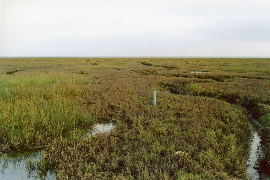
Image: salt marsh at Freiston Shore, The Wash, eastern England. Urs Neumeier, CC BY-SA 2.5, via Wikimedia Commons.
Comments